Explore
 Shop
Shop About
About Search
Florida's Aquatic Land Cover
How water shapes urban planning in the "Sunshine State"

The Island Walk neighborhood in Naples, Florida.
How water shapes urban planning in the "Sunshine State"
The Island Walk neighborhood in Naples, Florida.
Words by Susanna Moreira
Translated by Tarsila Duduch
---
The U.S. state of Florida is bordered to the south, east, and west by the Atlantic Ocean, with a coastline of over 1,300 miles (2,100 kilometers) in length, and is characterized by extensive areas of lakes, rivers, and ponds. Land booms during the early and mid-20th century resulted in the development of new communities and the expansion of low-density suburbia across many parts of the state, which frequently incorporated the abundant water resources, sometimes failing in their efforts.

Land-use trends throughout the state’s history have been directly influenced by the natural resources, geomorphology, and climate that exist within the state. Since 1900, Florida has seen substantial changes in land-use patterns and land cover due to significant increases in population and tourism, coincident with new development, facilitated by new railroads and highways, and inspired by an aggressive marketing campaign for new residents and visitors to come to the state.
One of the first major land booms occurred after World War I. By this time, middle-class people had the time, money, and means to travel to Florida. With cities developed to attract tourists but also to meet the needs of visitors that were interested in buying homes, developers built new communities, destinations, and attractions, causing significant changes to the natural landscape and resources of the state, fragmenting and degrading the land, introducing invasive species, and exploiting natural resources.
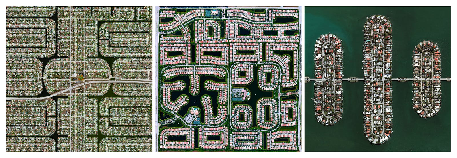
From left: Cape Coral, Delray Beach, and the Venetian Islands of Miami, Florida.
Following World War II, development in Florida boomed again, with the state’s population growing from 2.8 million by 1950 to 6.7 million people by 1970. New home financing options and improved construction techniques that lowered costs made homeownership possible for more people. Developers set out to build large suburban communities that sometimes included shopping, schools, parks, and community centers, also creating new canals and lakes to maximize the amount of waterfront property.
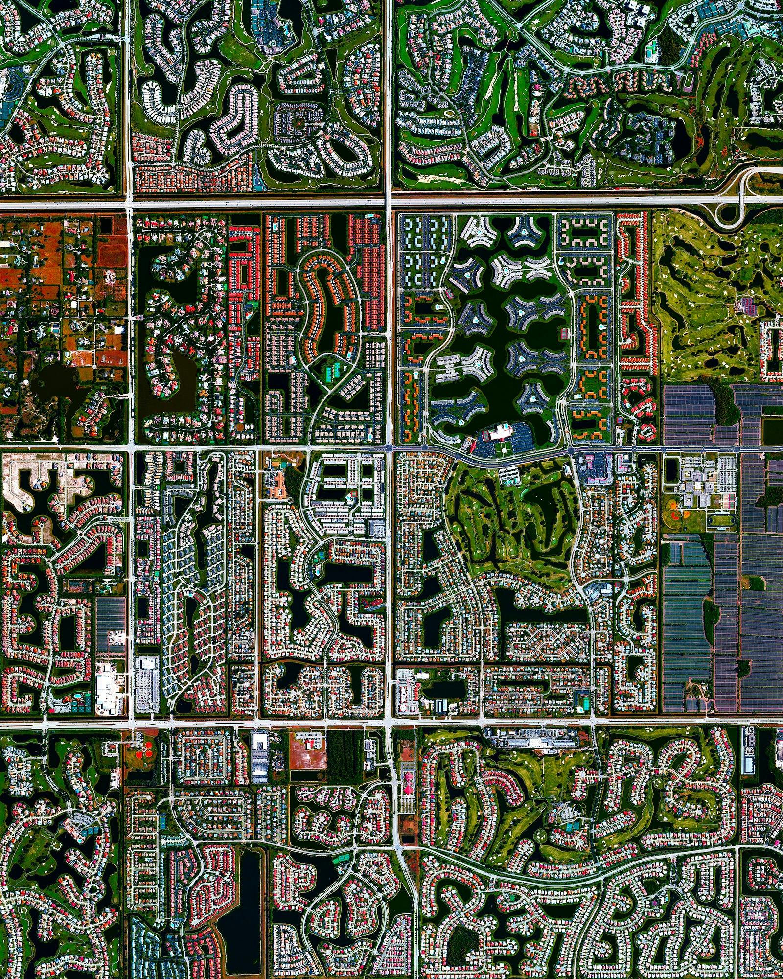
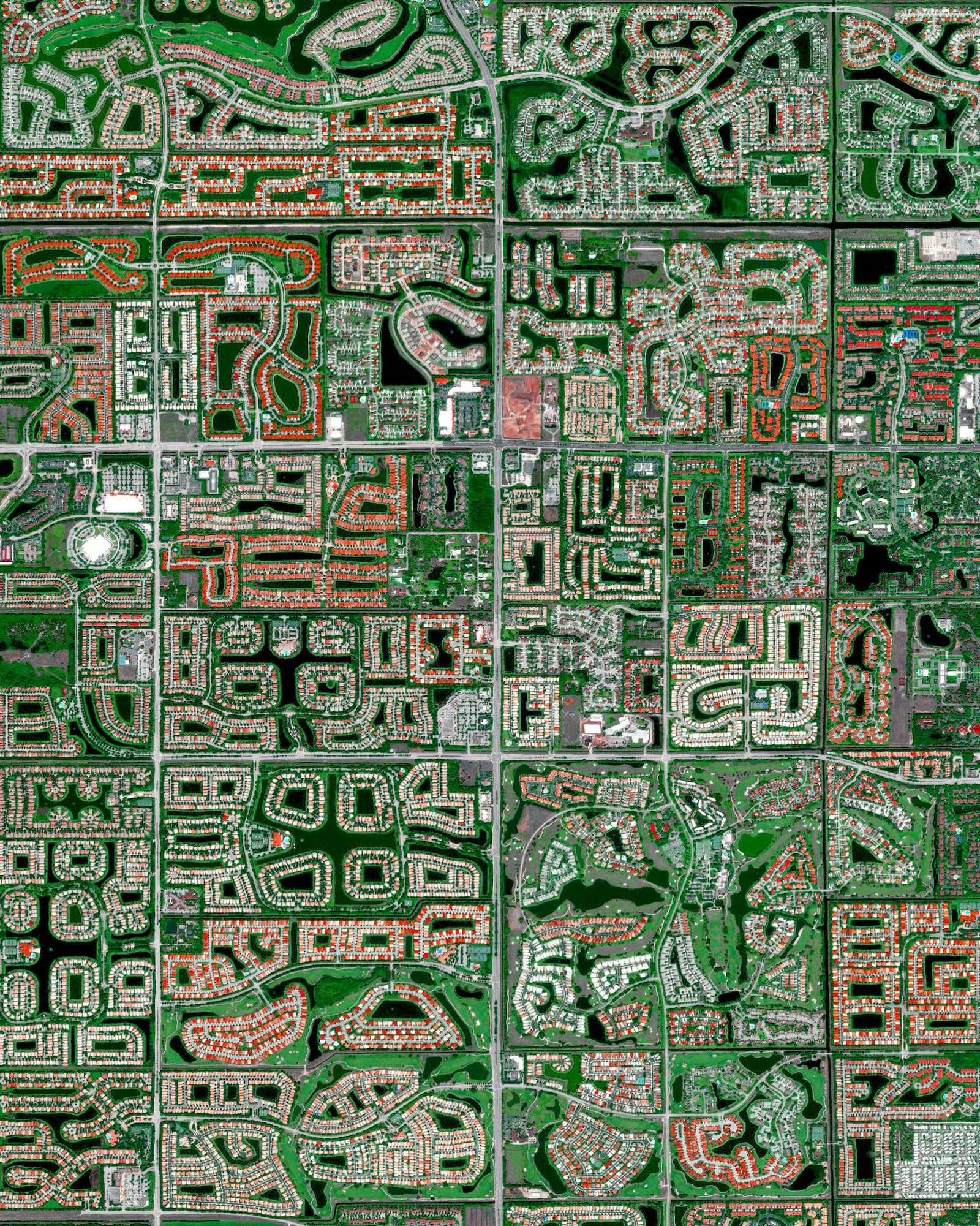
The state's population growth encouraged urban planning based on the creation and incorporation of water bodies, which led to the rise of cities such as Boca Raton, Delray Beach, Boynton Beach, Naples, and Cape Coral — the first three located in Palm Beach County, in the southeast of the state, where 17.3% of the surface is covered with water. Water has been strategically integrated into the layouts of these locations as a developmental resource to create compelling environments and to promote visual, acoustic, and recreational effects.
By observing aerial images of these locations, it is possible to notice the different ways in which the urban layouts, lakes, and canals were developed and incorporated into the territorial planning of each city. Variables such as land use, the possibility of carrying out aquatic activities (such as fishing, swimming, and navigation), and the integration with other nearby navigable canals have shaped these water bodies alongside the land distribution, resulting in sinuous and winding patterns.
Boca Raton, Florida
However, water resource management has not always been successful. Before the development of the area where the city of Cape Coral is located, in the southwest of the state, water was widely distributed on the surface and in shallow aquifers. According to Hubert Stroud, professor of geography at Arkansas State University, these resources degraded as soon as the Cape Coral developers began subdivision operations. According to Stroud, the layout, design, and construction techniques were particularly devastating for the water resources. Instead of using phased development, the area was dredged, filled, and segmented long before it was occupied. The resulting gridiron pattern of roads is interrupted by occasional sinuous canals.
Before development, the peninsula that is now the location of Cape Coral was covered with wetlands that were vital to groundwater recharge, storing and purifying large volumes of water that drained into them from higher elevations. The development of Cape Coral resulted in extensive environmental degradation of the water resources, caused by soil erosion, urban runoff, and sewage from septic tanks.
Boynton Beach, Florida
Florida is a state marked by a large number of water resources, whether on the coast or inland, on the surface or underground, and many cities and communities have considered them to be key elements in urban planning, exploring their most diverse potentials. The alliance between planned cities and water resources in Florida not only reveals the curious patterns of roads and canals, seen in aerial photographs, but also the complex relationship between water and land in the context of the city, showing that water is more than just a resource for landscaping or aesthetics, it is a fundamental element in urban infrastructure.
---
This story was created in partnership with ArchDaily. To see the full story, click below:
"Urban Planning and Water Bodies: Florida’s Aquatic Land Cover"